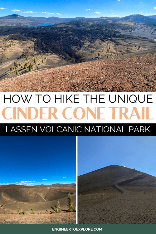
The Cinder Cone Trail in Lassen Volcanic National Park in northern California might be my favorite hike I’ve ever done. Your lungs and calves will burn during the last part of this hike, but the unique views and chance to hike into an actual volcano are oh so worth it!
You’ll hike through a meandering pine forest, see some insanely tall lava flows, and then climb up the cinder cone volcano for sweeping views of the unique scenery. This challenging hike is definitely worth the climb!
My husband and I visited Lassen Volcanic National Park in September of 2023 and hiking the Cinder Cone Trail was definitely the highlight of the trip. This park and trail are highly underrated, so it’s unlikely that you’ll see anyone else on the trail!
This post is all about how to hike the Cinder Cone Trail in Lassen Volcanic National Park. I’ll include hiking stats, how to get to the trailhead, and a step-by-step guide to the hike.
2021 Dixie Fire Update
During the summer of 2021, the Dixie Fire burned almost 1 million acres in Northern California, making it the largest single fire in California history. The southeast corner of Lassen Volcanic National Park was the most severely burned area in the park.
Lassen Volcanic National Park is open, but remnants of the fire damage are still evident in some areas. The Drakesbad Guest Ranch (the only in-park lodge) remains closed for the 2024 season and is expected to reopen in 2025.
The Butte Lake area of the park (where the Cinder Cone Trail is located) was largely unaffected by the fire. The campground, trails, and facilities here are open and accessible.
There are still plenty of fantastic ways to enjoy Lassen Volcanic National Park despite some areas being closed!
As always, check the NPS website for the latest info on reopening plans after the Dixie Fire before planning your trip.
Cinder Cone Trail Hiking Stats
Length: 4.7 miles
Elevation gain: 1053 feet
Type: out-and-back
Difficulty: strenuous
Time: 3 hours
Trailhead location: Butte Lake Campground
Facts About the Cinder Cone Volcano
Cinder cones are formed from volcanic eruptions that eject small pieces of lava that accumulate over time and form a cone-shaped hill.
The Cinder Cone in Lassen Volcanic stands over 700 feet tall with a diameter of 1050 feet. It has two concentric craters at the top that were most likely formed during two separate eruptive periods.
The greater Lassen area has been volcanically active for over 3 million years. The Cinder Cone last erupted about 350 years ago, which means it is technically still an active volcano. The most recent eruption in the area was the park’s namesake, Lassen Peak, roughly 100 years ago.
Similar cinder cones are found at Craters of the Moon National Monument in Idaho and Sunset Crater Volcano National Monument in Flagstaff, Arizona.
Best Time to Visit Lassen Volcanic National Park
The best time to visit Lassen Volcanic National Park is in the summer between July and September. This area of California is at an elevation of 6000+ feet, so it gets a lot of snowfall in the winter and the park roads close between October and May.
The weather in the summer will be very pleasant for hiking and outdoor adventuring. Don’t worry about summer crowds here either- Lassen is one of the least-visited National Parks in the US!
Related: 13 Fantastic Things to Do in Lassen Volcanic National Park
How to Get to the Trailhead
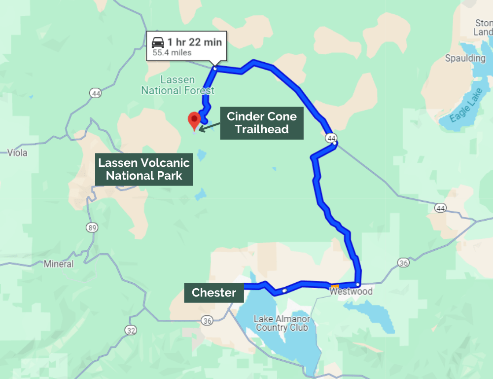
The Cinder Cone trailhead is located at the Butte Lake Campground. This is in the northern area of the park and is a bit out of the way from the Lassen Peak Highway.
From California Highway 44, you’ll turn off onto Forest Rte 32N21. This road will dead-end at the Butte Lake Campground where the trailhead is accessed from.
The last few miles of Forest Rte 32N21 is a gravel road, but you’ll be fine in any vehicle. Our Buick Encore rental car did just fine!
Step-By-Step Guide to Hiking the Cinder Cone Trail
1. Hike Through the Ponderosa Pine Forest
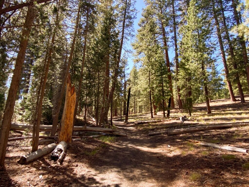
You’ll begin your hike on the Cinder Cone Trail by walking slightly uphill for a mile and a half through the ponderosa pine forest.
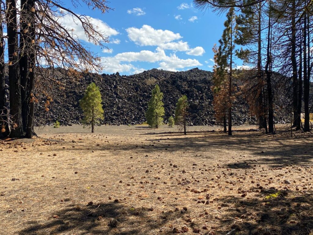
The fantastic lava beds will be on your left. They were so much taller than I expected!
2. Climb the Cinder Cone
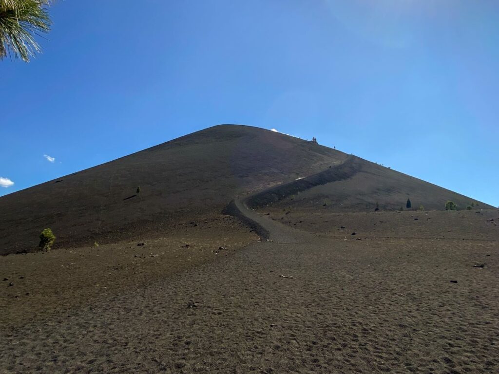
Once you reach the cinder cone, the fun really begins. Feel free to take a rest on the log located under the tree right before the climb (this is also a good place to empty your shoes of volcanic sand on your return hike!).
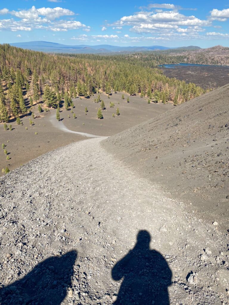
You’ll climb over 200 feet in less than a half mile through some loose volcanic sand as you circle around to the south side of the volcano. Every step you take forward results in a half-step back. My husband described this part of the hike as if “you are walking on Fruity Pebbles.”
Your calves will get a good workout on this part of the hike! Take your time and drink plenty of water. We started counting our steps at this part to keep us motivated.
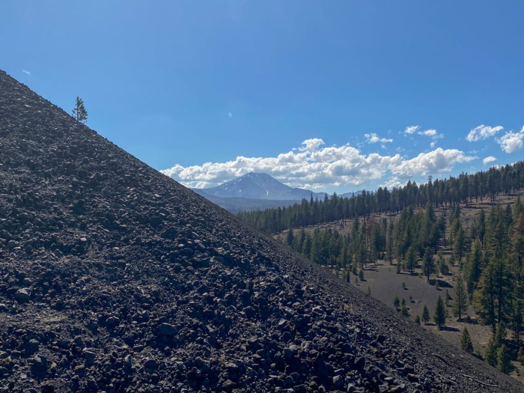
As you summit the cone, you’ll see the Lassen Peak off in the distance.
3. Explore the Peak
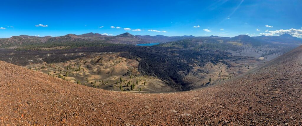
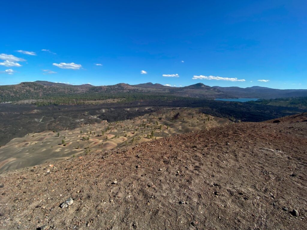
When you finally reach the peak, you will take in the incredible views of the Painted Dunes, Fantastic Lava Beds, Lassen Peak, Snag Lake, and Prospect Peak. The Painted Dunes might have been the weirdest landscape I’ve ever seen!
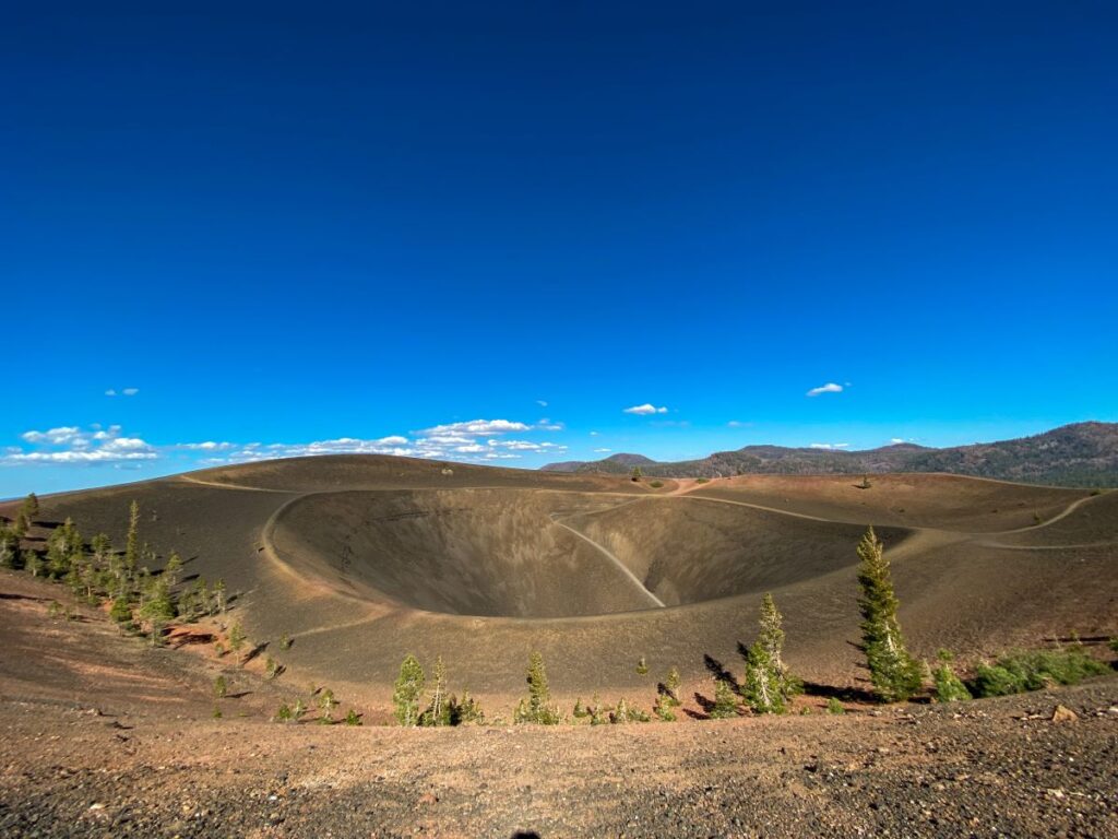
You’ll also notice that there are two paths that circle the top of the Cinder Cone along with a trail that leads down into the center. I encourage you to walk both trails and take in the views from all angles.
4. Hike Down into the Cinder Cone
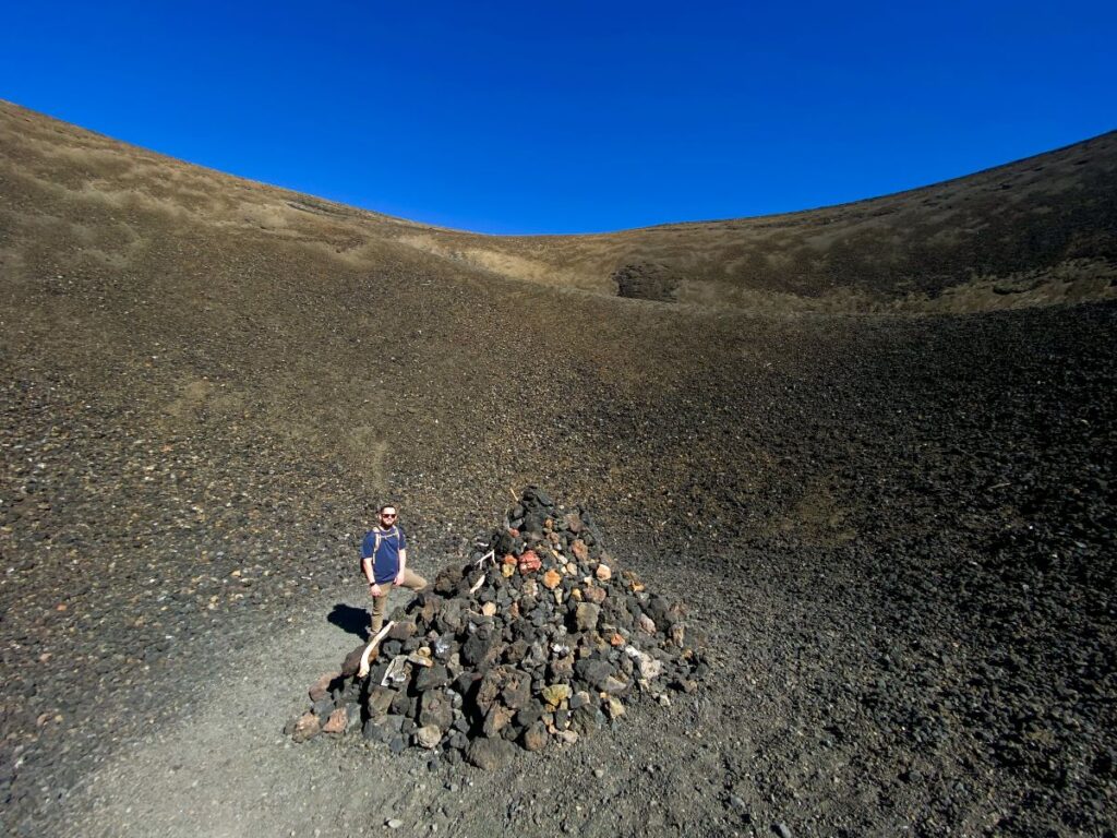
If you’re up for it, take the trail down into the Cinder Cone, where you’ll find a huge pile of rocks.
Yes, this adds a little more elevation gain to your hike through the loose volcanic sand, but you will be totally fine if you made it up the Cinder Cone. It is worth it to tell your friends that you hiked into a literal volcano.
5. Descend the Cinder Cone & Retrace Your Steps
When you’re done exploring the top, retrace your steps back down the Cinder Cone and onto the trail.
Walking down the Cinder Cone is considerably less strenuous than going up, and we had fun running down and sinking into the volcanic sand, completely energized after making it to the top!
Congratulations, you just hiked one of the most incredible and unique trails in the park!
What to Expect on the Trail
Expect minimal cell signal in Lassen Volcanic National Park. Download your maps ahead of time and don’t expect to be able to send texts or check social media.
Hiking up the cinder cone through loose volcanic sand is strenuous. You will get dusty and your shoes will fill with the stuff. Take your time and enjoy the journey.
Hiking at elevation will likely be more strenuous than you are used to. Lassen Volcanic National Park sits between 6000 and 8000 feet above sea level, so consider your fitness level and don’t be afraid to take breaks while hiking!
Stay on the established hiking trails. Going off-trail (especially when climbing the Cinder Cone) will damage the fragile ecosystem here. Stay on the trail, pack out all of your trash, and practice the principles of leave no trace.
The Cinder Cone Trail is one of the most unique and rewarding trails I’ve ever done. You cannot miss this hike on your visit to Lassen Volcanic National Park!
Let me know if you have any questions about hiking the Cinder Cone Trail in the comments below and I’ll do my best to answer them!
-Megan
More Information on Northern California
MORE ON LASSEN VOLCANIC NATIONAL PARK: Check out my guide on the best things to do in Lassen Volcanic National Park, the best hikes in Lassen, and how to spend 1, 2, or 3 days in Lassen Volcanic National Park.
BURNEY FALLS STATE PARK: Burney Falls State Park is an incredible park with an easy hike to a 129-foot waterfall. It’s located an hour and a half north of Chester. You can combine the Cinder Cone Trail with a visit here (you’ll drive right by the turn off for the Butte Lake Campground on your way to Burney Falls) for an awesome day in Lassen!
REDWOOD NATIONAL PARK: Redwood National Park is home to the tallest trees in the world. It’s located along the northern California coast about 5 hours from Lassen Volcanic National Park. Here’s how to explore Redwood in just one day.
NORTHERN CALIFORNIA ROAD TRIP: Spend 9 days road tripping through Northern California with this fun itinerary geared toward hikers. You’ll see Redwood and Lassen Volcanic National Parks, and with more time you can visit Crater Lake in Oregon as well. Other highlights are Burney Falls State Park, the California coast, and Point Reyes National Seashore.

